APPENDIX II
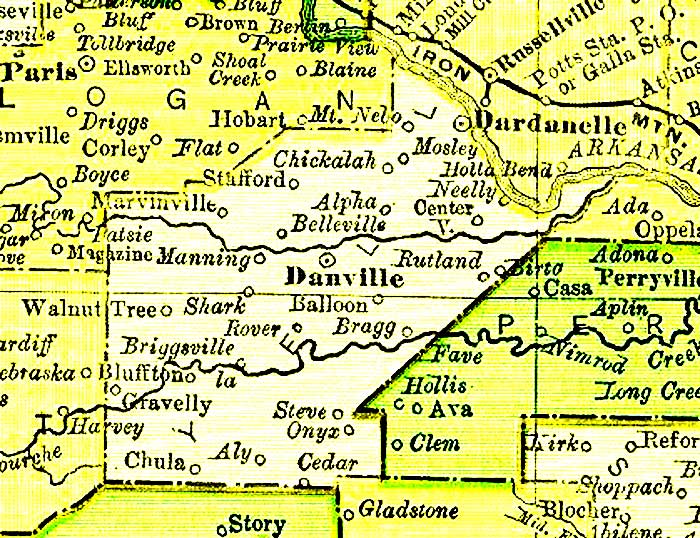
Yell County, Arkansas, 1895.
Today, Ola has replaced Rutland, though not in the same location. An 1898 map places Rutland between Ola and Birta, but there is no town there today. Ola came to be because it was the location of the intersection of a railroad line extending south from Dardanelle and a line extending west from Perryville. When that connection was completed, commerce quickly moved to Ola, and Rutland does not appear on the 1936 Arkansas Highway Department map.
Plainview has replaced Balloon, thought not in the exact same location. Plainview was a logging camp founded in 1892. Plainview grew, Balloon didn’t.
The Saint Louis, Iron Mountain, and Southern Railroad, a portion of which is visible at the top of the map, became the Missouri Pacific Railroad in 1917.
At about the same time, the early 1900s, railroad construction connected Little Rock to the towns of Perryville, Casa, Birta, Ola, Danville, and on to Fort Smith. These would become a part of the Rock Island Line.